Building plan (BDA)Sanctioned 14 Oct 2025No. BDA/TPM/PRL-93/2650
RERA extensionsNone on the filingFiling read 20 Oct 2026
RERA complaints0✓ClearClear
Land conversionConverted 18 Feb 2025Deputy Commissioner
Permits
Validity
Not verified yet
Approval letters
Disputes & cases
Are there court cases or buyer complaints on this project?
Locked
Cases on the landNot checked
Cases on the builderNot checked
RERA complaintsNo cases
Builder's other projectsNo cases
Unlock this full report
₹99 for this report opens Contract & costs and Disputes & cases for this project, yours to read for good.
Contract & costs
What does a buyer commit to?
Locked
Forfeiture, agreement•• %
Forfeiture, allotment letterNot verified yet
Transfer feeNot verified yet
Maintenance includedNot verified yet
Cancellation
Forfeiture
Not verified yet
Agreement and allotment letter
Valuation
What is it worth?
We haven't verified the rest of this yet.
Sign in first, then it is one click.
Recent price, super built-upNot verified yet
Recent price, carpetNot verified yet
Phase 1 → Phase 2Not verified yet
Gross yield, per sq ftNot verified yet
This project
Price
Price per sq ft, super built-up
Location & risks
What is the location like?
Height above nearest drainNot verified yet
Groundwater, taluk average21.3 m below groundAnekal taluk, July 2023
Water supply, as filedBorewell, Local authority (Hulimangala Grama Panchayati)Declared by the promoter
Metro, operationalabout 6 kmInfosys Foundation Konappana Agrahara
The site
Zoning & hazards
Construction & progress
How is it being built, and when will it be ready?
Clear1 clear
Completion35%As of Q4 2025-26, promoter's return
Possession, agreement30 Jul 2028Agreement for sale, p. 14
StructureNot verified yet
Structural safety certificateNot verified yet
Progress
Completion, architect
Not verified yet
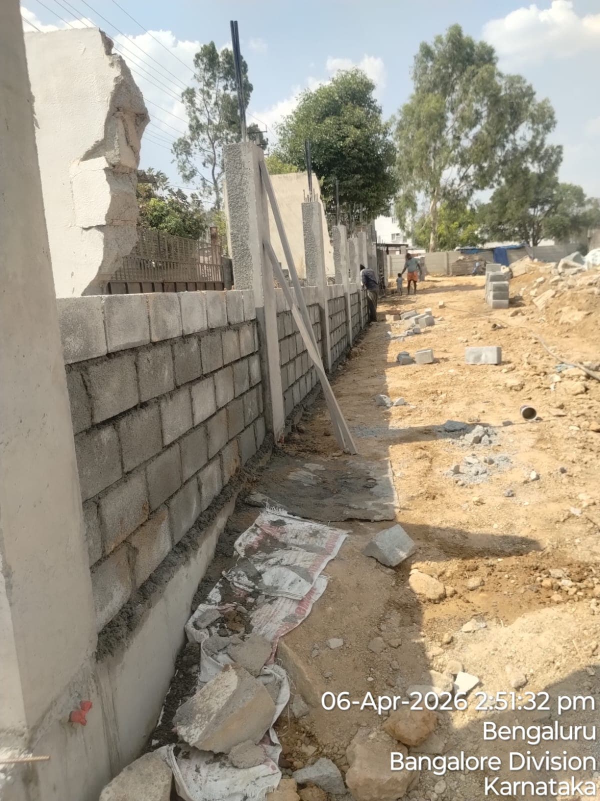
Site photos filed with K-RERA, Q4 2025-26
Developer
Can the developer deliver?
Receivable, sold flatsNot verified yet
Cost leftNot verified yet
SoldNot verified yet
Sold in the latest quarterNot verified yet
Funding
Estimated cost
Loan & collateral
Can it be financed?
Value, 3BHK ANot verified yet
Max loan, 3BHK ANot verified yet
Borrower marginNot verified yet
Developer's project loanNo borrowing declaredAs declared in the K-RERA filing
Value & LTV
3BHK A
Not verified yet
Calculation
Not verified yet
Conditions
Collateral checks
Data room
Documents filed for this project
Documents filed90On K-RERA
Available8898% of filed
K-RERA only2
Approvals with a validity dateNone read
Approvals & NOCs
2 pagesAvailable
1 pageAvailable
K-RERA only
K-RERA only
Filed 10 Feb 20262 pagesAvailable
Filed 10 Feb 20261 pageAvailable
Filed 10 Feb 2026Available
Filed 10 Feb 20264 pagesAvailable
Source: K-RERA project page and the documents filed there, as read by us. 29 documents filed with K-RERA, identity papers and photographs, are left out of this list.
Unlock this full report₹99 for this report · opens Contract & costs and Disputes & casesUnlock
Imagery: Esri, Vantor, Earthstar Geographics
Satellite map with the 2 cadastral survey plots named in the filing outlined. The outline is the land, not the building. All 2 filed survey numbers matched. Survey numbers read from the filed land documents and checked against the cadastre by an independent reviewer, 9 Oct 2026. Some drawn plots are whole survey numbers, not the project's own share of them; they show where the land is, not the site.
Map of drains, lakes, metro, high-tension lines and government-flagged flood locations within 3 km of the filed pin, with rings at 3 km. Approximate location: the filed pin, good to the neighbourhood, not the plot. The dashed ring is 1 km: of the approximate pins that could be checked against the surveyed land, nine in ten sat within it.
Storm drain, primary
Storm drain, smaller
Lake or tank
Metro lines (dashed: planned)
High-tension line, 765, 400, 220 and 66 kV
Its corridor, to scale
Buried cable
Approximate location: the filed pin, good to the neighbourhood, not the plot
Everything here is as filed by the promoter with Karnataka RERA or as recorded in Bhoomi land records, and can be stale or wrong at source. Verify against certified records before you transact. Open Terra Vista in the interactive atlas
Extent the filed land schedule names for these survey numbers
23,371 sq m
Plot area against the filed extent
1.45 times
Village, hobli and taluk on the KGIS map
S.I Bangipura, Jigani-2 hobli, Anekal taluk
Sketch dimensions
Not verified yet
Sanctioned plan area
Not verified yet
Mutation entry
Not verified yet
Land record
Survey plots · KGIS cadastral
Imagery: Esri, Vantor, Earthstar Geographics
Satellite map with the 2 cadastral survey plots named in the filing outlined. The outline is the land, not the building. All 2 filed survey numbers matched. Survey numbers read from the filed land documents and checked against the cadastre by an independent reviewer, 9 Oct 2026. Some drawn plots are whole survey numbers, not the project's own share of them; they show where the land is, not the site.
Map of high-tension power lines, storm drains and government-flagged flood locations within about 2 km of an approximate filed pin. Approximate location: the filed pin, good to the neighbourhood, not the plot. The dashed ring is 1 km: of the approximate pins that could be checked against the surveyed land, nine in ten sat within it.
High-tension line, 765, 400, 220 and 66 kV
Its corridor, to scale
Buried cable
Storm drain, smaller
Approximate location: the filed pin, good to the neighbourhood, not the plot
Map of storm drains, lakes and government-flagged flood locations within about 2 km of an approximate filed pin. Approximate location: the filed pin, good to the neighbourhood, not the plot. The dashed ring is 1 km: of the approximate pins that could be checked against the surveyed land, nine in ten sat within it.
Lake or tank
Storm drain, smaller
Approximate location: the filed pin, good to the neighbourhood, not the plot
Across Anekal, the water table sat 21.3 m below ground in July 2023 (KSNDMC, a taluk average), shallower than the ten-year July mean of 28.7 m, and it recovered 3.3 m over the year.
Water at a glance
Groundwater
Anekal taluk average, July 2023: 21.3 m below ground
What it means
Not verified yet
Water below ground
21.3 m, the taluk average
Through the year
Not verified yet
Water supply, as filed
Borewell, Local authority (Hulimangala Grama Panchayati)
Nearest city water main
Not verified yet
Distances
Within 3 km of the filed pin
Connectivity
Road distance from the site
Nuisances
Distance from the filed pin
Work left
By component
Not verified yet
Quarterly return, Q4 2025-26
Main structure
Not verified yet
Electrical and plumbing finishing
Not verified yet
Internal roads
Not verified yet
Club house
Not verified yet
Completion
35%
Completion, accountant
Not verified yet
Dates
Dates
Filed dates
Possession, agreement
30 Jul 2028
Schedule end
Not verified yet
RERA completion date
30 Jul 2028
Work began, as filed
24 Oct 2025
Specified structure
What the promoter specified · not an inspection
Not verified yet
Specification sheet, page 1
Page 1
Page 1 of the specification sheet. The promoter filed this with the registration.
Map of drains, lakes, metro, high-tension lines and government-flagged flood locations within 3 km of the filed pin, with rings at 3 km. Approximate location: the filed pin, good to the neighbourhood, not the plot. The dashed ring is 1 km: of the approximate pins that could be checked against the surveyed land, nine in ten sat within it.
Storm drain, primary
Storm drain, smaller
Lake or tank
Metro lines (dashed: planned)
High-tension line, 765, 400, 220 and 66 kV
Its corridor, to scale
Buried cable
Approximate location: the filed pin, good to the neighbourhood, not the plot